Parks & reserves: Boni & Dodori National Reserves
General info
It is very unlikely that your trip will include a visit to Boni or Dodori National Reserves, both located at the northernmost corner of Kenya's coast, next to the Somali border. Sadly, the reason is the high insecurity in the area, which is raided by Somali guerrillas. Visiting these reserves, specially Boni, is therefore strongly discouraged.
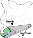
Both reserves were gazetted in 1976. Boni belongs to the Garissa County (North Eastern province), while Dodori lies on the Lamu County (Coast province). Dodori covers an area of 877 km², whereas Boni comprises 1,339 km². Boni lies right next to the Somali border, in the traditional dwelling region of the Boni hunter tribe, today reduced to a few hundreds of people. Dodori reserve is named after the river ending in the Indian Ocean at Dodori Creek, a breeding place for dugongs.
Dodori hosts a vegetal diversity mainly consisting of coastal and riverine forests, mangroves, swampy grasslands and savannah. Away from the rivers and channels, impenetrable thornbush is scattered with gigantic baobabs. At the Dodori coastal area, waterholes are frequently visited by gazelles, antelopes and water birds.
Access
Dodori lies 280 km north of Mombasa. As mentioned above, access by land to any of the two reserves is not recommended for safety reasons.
Anyway, none of the two reserves may be easily approached by car and the visit requires a 4WD vehicle.
There are hardly any roads and the only access is from Lamu, taking the road D568 inland and turning right at Bodhei. This track leads to Kiunga, in the north limit of the Kenyan coast, passing between both reserves.
Along the road, at the town of Mangai, a track allows for wildlife observation at both banks of Dodori river. Once in Kiunga, the road to Mkokoni borders the coast and provides access to some waterholes amongst the bush. However, the area is only passable in the dry season.
The easiest access is by sea, specially if you wish to watch the rich marine wildlife at Dodori. The creek, its channels and mangroves can be reached by boat or dhow.
Wildlife
Dodori's main wealth is its topi population, one of the largest in Kenya. Other mammals include elephants, gazelles, lesser kudus, zebras and lions. The channels are breeding grounds for the green turtles and the dugongs or sea cows, endangered aquatic mammals which feed on the sea grass.
Bird life at Boni and Dodori has not yet been deeply researched. The wet areas attract large numbers of palearctic migratory birds. Pelicans and other water birds are frequent in the channels and waterholes, while prey birds also abound. Bird species recorded include brown-hooded kingfisher, Violet-breasted sunbird, European and carmine bee-eaters, honey buzzard, palmnut vulture, southern banded harrier eagle and brown-breasted barbet.
Lodging
There are no lodging facilities at the reserves. Dodori's sea wildlife could be watched from the nearby Kiwayu Safari Village, a rustic luxury secluded beach lodge located in Kiwayu island close to Lamu and Kiunga Marine Reserve. However this resort was closed in 2011 after a couple of British tourists were tragically attacked by Somali gunmen.
Camping
There are no campsites at these reserves. Staying on your own is strongly discouraged due to the unsafety situation in the region. However if you wish to know about the regulations and the current risk level, you may contact the officials at Lamu and Garissa counties.
|