Parks & reserves: Aberdare National Park

 Managed by:
 KWS
Safari Card: Yes
|
 The high moorlands. J.Y./Kenyalogy.com
|
General info
 Aberdare national park is located in the range of the same name, described by Joseph Thomson in 1883 during his journey through the Maasai Land. Kikuyu people still use the range's traditional name, Nyandarua. From 1947 to 1956, the misty and rainy forests in the range served as a hide for the Mau-Mau guerrilla. The park was gazetted in 1950 with an extension of 584 km², but was afterwards enlarged to 770 km², making it the third largest park in the country.
The Aberdare range, 160 km long, is located in the Central Highlands, Central Province, west of Mount Kenya and north of Nairobi, serving as the Kenyan Rift Valley's east wall. The national park comprises a longitudinal strip from south to north, with a projection toward the east denominated The Salient, that runs down to an altitude of 2,130 m, near the town of Nyeri. The Salient has its origin in an ancient migratory route of elephants between the range and Mount Kenya.
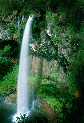
The park is the highest in all Africa, since most of the plateau is located above an altitude of 3,000 m. The highest peaks in the park are the Kinangop, with 3,906 m, and the Oldonyo Lesatima, 'the mountain of the young bull' in the Maa language of the Maasai, with 4,001 m. The landscape is dominated by deeply foggy rain forest, which confers the park a fairyland atmosphere. Trouts breed in the mountain streams, that burst down spectacular waterfalls, like the Keruru Kahuru of 270 m and the Gura of 240 m in the South area, or the Chania Falls in the central sector of the park. Due to the high humidity, the tracks crossing the park are muddy for a large part of the year.
Aberdare contains a rich botanic wealth, a mixture of equatorial exuberance and alpine vegetation. Above the 2,000 m level, the rain forest gives way to the bamboo jungles, that at 3,000 m become mountain prairies in which groundsel and giant lobelias grow high.
Though the park registers a high number of visitors, most of them just do it for an overnight stay at its famous lodges, reason why in fact the park is largely unknown for most of the visitors.
|


